Added 1 day ago
Super Lot, 10-26 Worland Road,
Wangaratta, VIC 3677
Development Sites & Land
Added 1 day ago
Key property information
Land area
Private inspections
to arrange a private inspection.
Map of Super Lot, 10-26 Worland Road
Train stations within 5 km of Super Lot, 10-26 Worland Road, Wangaratta, VIC 3677 Distance Wangaratta Railway Station 2.7 km POWERED BY HERE ©Bus stops within 5 km of Super Lot, 10-26 Worland Road, Wangaratta, VIC 3677 Distance St Johns Village Hostel/Williams Rd (Wangaratta) 172 m Corvino BVD/Williams Rd (Wangaratta) 309 m Collyn - Dale Dr/Williams Rd (Wangaratta) 562 m Cavanagh StEsmond St 805 m Tudgey StCavanagh St 811 m POWERED BY HERE ©
POWERED BY HERE ©
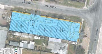
GROWTH-AREA DEVELOPMENT SITE
* Level 2,077m² General Residential Zoned allotment
* Suitable for high density residential (townhouse), childcare or medical development (STCA)
* Positioned within Wangaratta’s North West Growth Corridor
* Located within the Worland Gardens Estate
* Neighbouring to proposed future Coles supermarket
* Short drive to five major primary and secondary schools
* Strong residential catchment growth supporting long-term demand
Wangaratta, 3677 demographic data
The median household income for Wangaratta is $1,218, 12% lower than Regional Victoria's household income of $1,386. Wangaratta has an older age profile compared to the rest of Regional Victoria (median age 44 vs 43). Property ownership data shows 44% of property owners in Wangaratta have a mortgage.
19,214
Population
$1,218 per week
Median household income
44 years
Median age
Owners
Most residents
Families
Most households
04758148...
Super Lot, 10-26 Worland Road
Wangaratta, VIC 3677

Garry Nash & Co - Wangaratta23 Baker Street
WANGARATTA, VIC 3677
WANGARATTA, VIC 3677
Similar properties
Other properties you might be interested in based on the location and property type you are looking at.
$1,499,000 plus GST if applicable
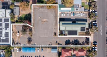
40 Mackay Street,Wangaratta, VIC 3677 3189 m²Development Sites & Land • Warehouse, Factory & Industrial • Medical & Consulting


For Sale by Expression of Interest
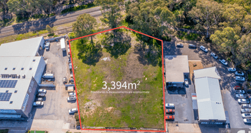
12-14 Tone Road,Wangaratta, VIC 3677 3394 m²Development Sites & Land